
From install to mapped community in minutes
-
01
Install the Package
Install from AppExchange. Namespace rlmx with permission sets and metadata deployed automatically.
-
02
Configure Your Map
Choose OpenStreetMap, ArcGIS, Google Maps, or QGIS. Add API keys to Custom Metadata if needed.
-
03
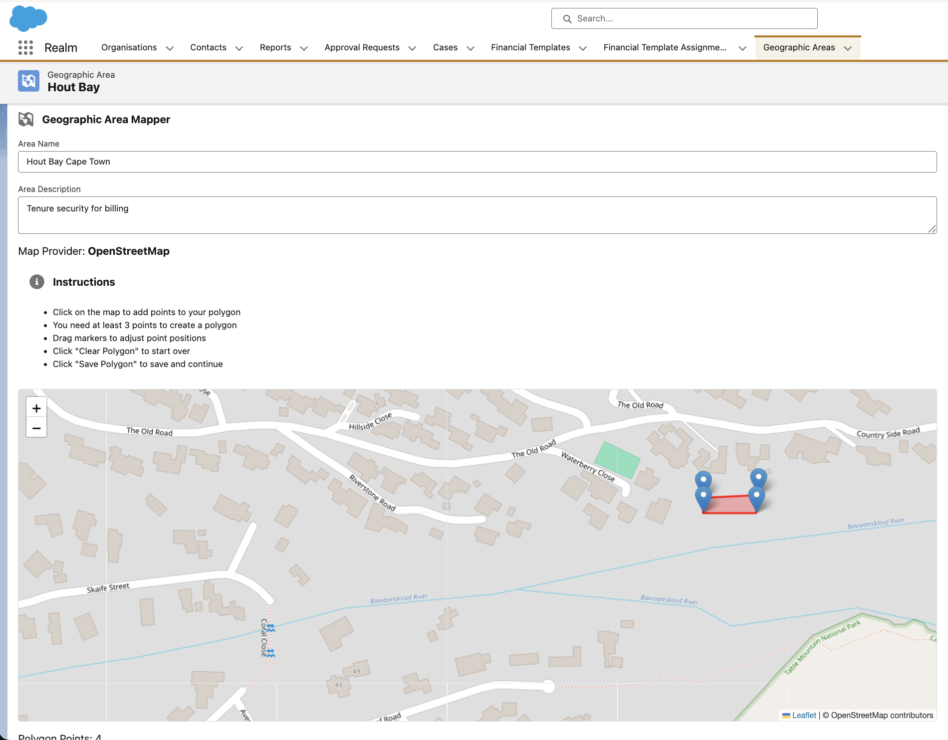
Draw Geographic Areas
Search by name, then draw a polygon or drop a point. Claude or Overpass can resolve informal settlement names.
-
04
Link and Analyse
Attach Households to areas, run AI structure segmentation, and manage tenure through built-in approval workflows.
Everything in one managed package
All features live inside your existing Salesforce org with no middleware and no separate database.
Geographic Area Mapper
Draw polygons or drop points on any map provider from within Salesforce Screen Flows and Record Pages. Saves GeoJSON, WKT, and coordinate formats.
Household and Tenure Management
Link Households to Geographic Areas, assign a Head of Household contact, and track every field change with built-in Salesforce history tracking.
Document-Gated Approvals
Salesforce-native approval process enforces ID Document and Proof of Ownership before submission.
AI-Enhanced Area Search
Resolves unofficial and informal settlement names via Overpass regex search on OSM tags, optionally enhanced by Claude AI.
Gemma 4 Structure Segmentation
Analyses satellite imagery to identify informal housing, formal housing, commercial, and industrial structures.
Salesforce 2GP Managed Package
Second-generation managed package with namespace rlmx, handlers, permission sets, and AppExchange-ready metadata.
Two optional AI engines, one platform
Both are configured via Custom Metadata. No key means graceful fallback: OSM-native search still works without Claude, and the map remains functional without Gemma.
Satellite Structure Segmentation
Gemma 4’s multimodal vision analyses satellite tiles from ESRI World Imagery or Google Maps Static, returning polygon boundaries for each detected structure cluster.
- Identifies informal vs formal housing from aerial imagery
- Returns normalised coordinates converted to real lat/lng
- Confidence-weighted overlays on the interactive map
Intelligent Area Name Search
Claude generates spelling variants, local-language alternatives, and nearby official names so informal or unofficial areas are easier to find.
- Generates alternative search strings per query
- Handles informal settlement names absent from official databases
- Merges and deduplicates results with Overpass OSM search
Built for communities that need it most
Designed for municipalities and NGOs working in developing urban environments.
Informal Settlement Mapping
Draw boundaries around informal settlements, link households to geographic areas, and use Gemma 4 to auto-detect structure types from satellite imagery.
Land Tenure and Housing Projects
Manage household registration, document verification, approval workflows, and automated notifications inside Salesforce.
Municipal Billing Systems
Link contacts and households to geographic billing zones, with history tracking for auditable records of every change.
Agricultural and Crop Monitoring
Define farm and crop boundaries as geographic areas, associate them with contacts, and monitor land-use change with satellite imagery.
Request a Realm demo
Speak to DFORUM about how Realm can support geographic intelligence, household workflows, and place-based operational data in your organisation.
Request Realm demo
Complete the required fields and your demo request will be sent to connect@dfum.org.